How We Mapped an Entire Industrial Facility to Millimeter Accuracy
When Traditional Surveying Can't Keep Up
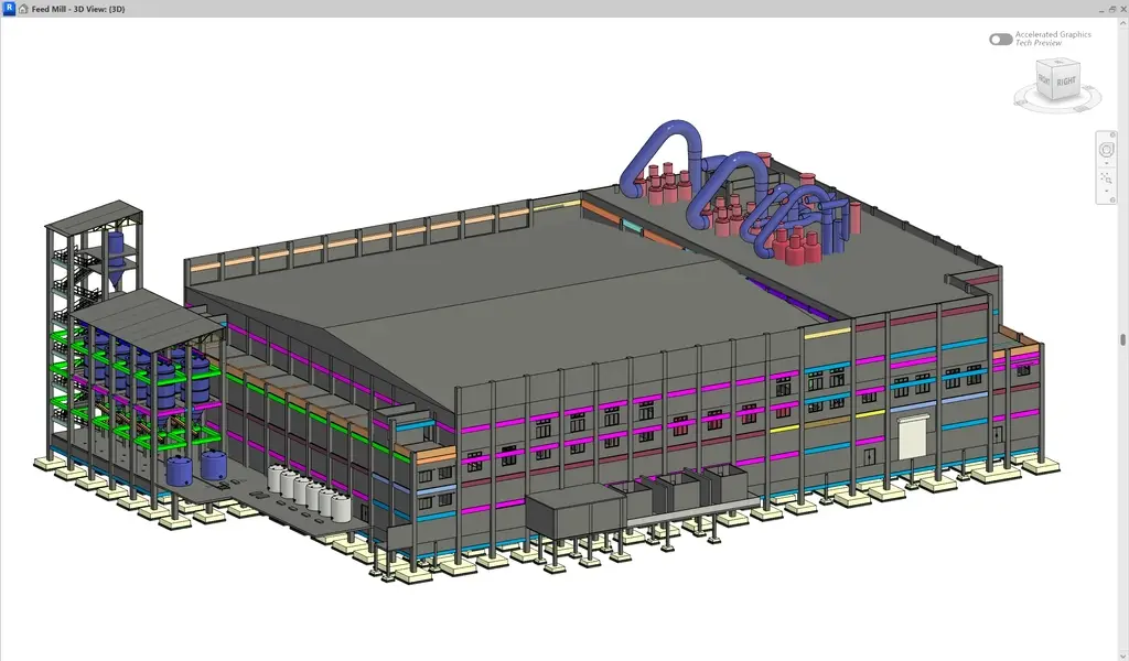
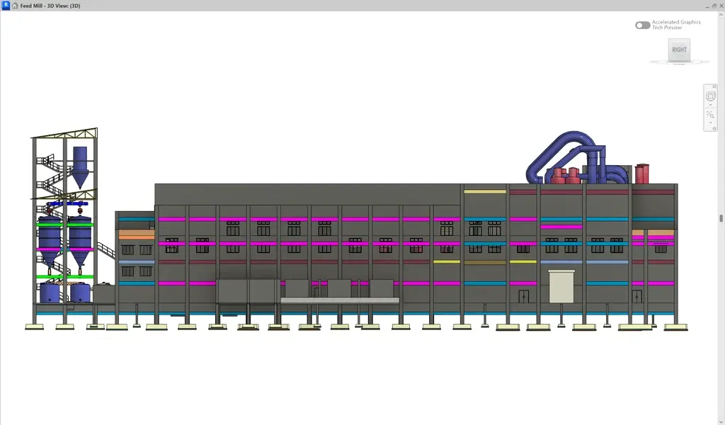
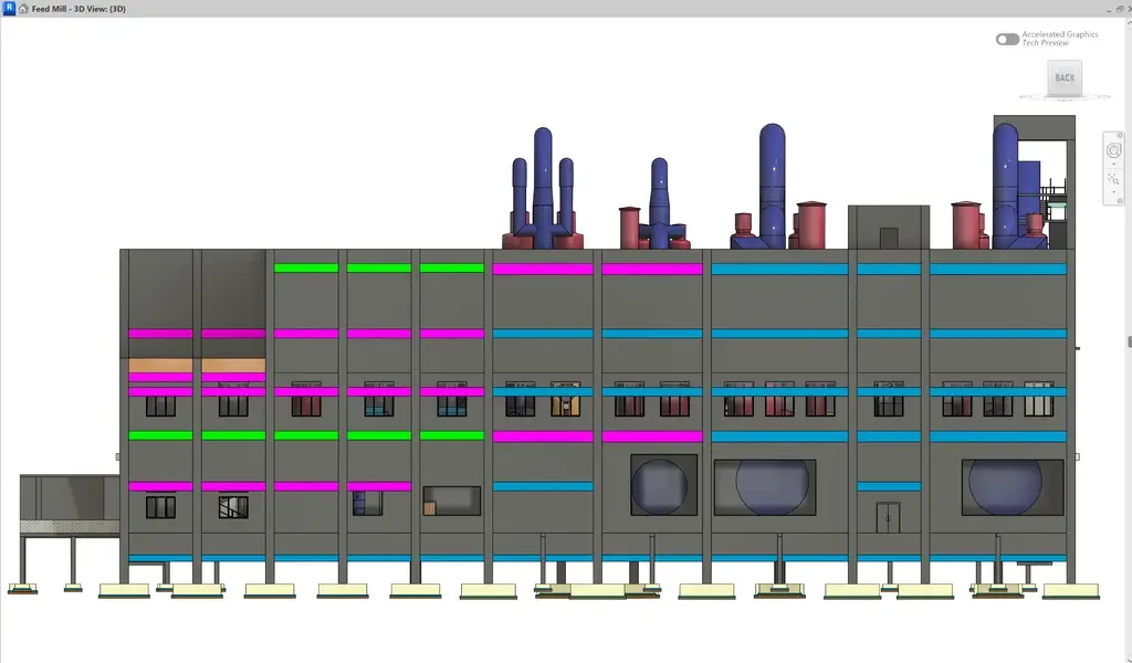
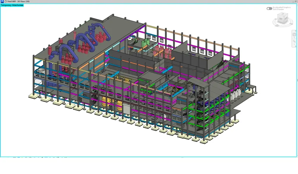
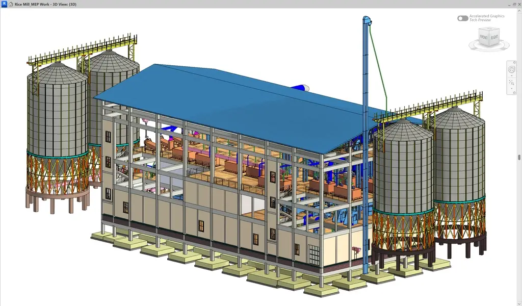
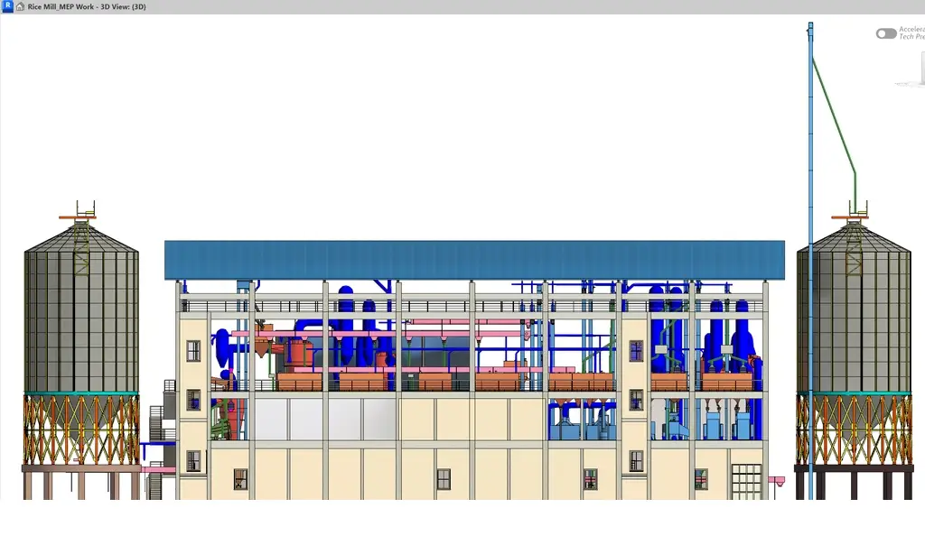
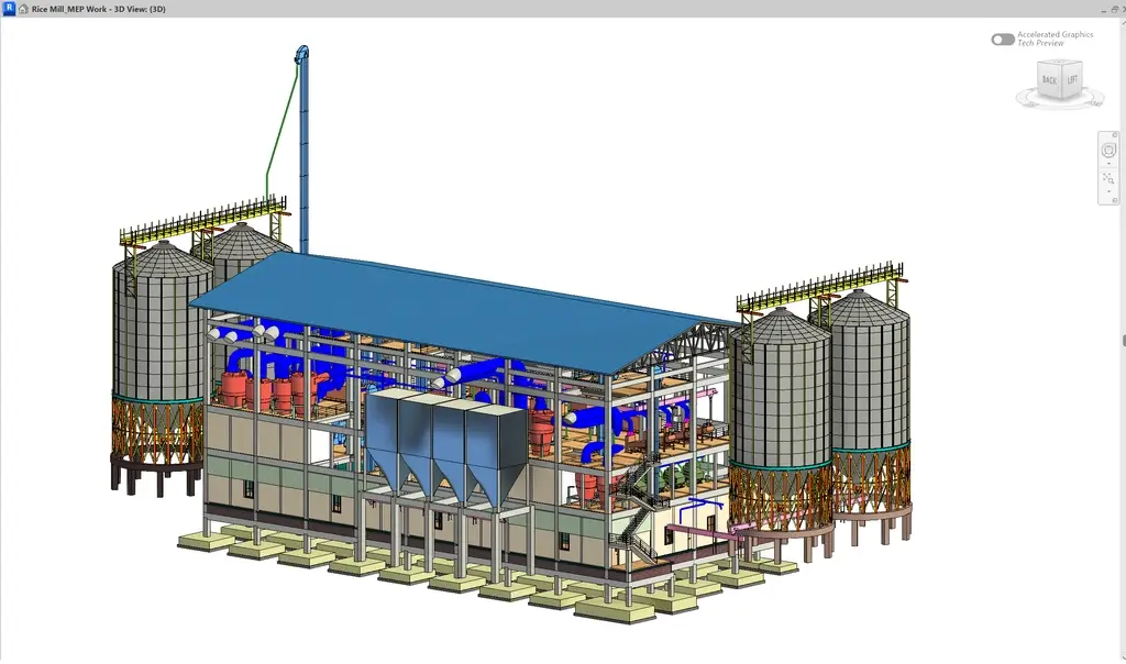
Imagine trying to document a sprawling industrial facility - complete with intricate piping networks, multi-level structures, and critical equipment placements - using traditional surveying methods. The timeline? Weeks. The accuracy? Questionable. The operational disruption? Significant.
A leading industrial organization in Tamil Nadu faced exactly this challenge when planning a major infrastructure upgrade. They needed something traditional methods couldn't deliver: millimeter-level precision, minimal downtime, and a digital foundation for future expansion.
That's where TAS stepped in.
The Challenge
The project wasn't just about measurement - it was about transformation. The client required a complete digital replica of their facility that could support immediate planning decisions while creating a scalable foundation for digital infrastructure management.
What Made This Project Complex:
- Massive scale – Thousands of square meters spanning indoor and outdoor industrial spaces
- Structural density – Multi-level facilities with tight equipment layouts and overhead systems
- Operational constraints – Active production meant zero tolerance for extended shutdowns
- Accuracy demands – Engineering applications required millimeter-level precision, not approximations
- Access limitations – Narrow corridors, restricted zones, and hard-to-reach areas throughout
Traditional surveying would have taken weeks, disrupted operations repeatedly, and still struggled to capture the detail engineering teams needed for confident decision-making.

The TAS Solution: Hybrid Reality Capture
Instead of choosing between speed and accuracy, we deployed both - simultaneously.
Our Dual-Technology Approach
We combined two cutting-edge scanning technologies to deliver comprehensive coverage without compromise:
Terrestrial Laser Scanning (TLS) handled critical structural elements where absolute precision was non-negotiable. These high-precision systems delivered millimeter-level accuracy, capturing every structural detail, surface characteristic, and spatial relationship. Think of it as the "detail specialist" -slow, methodical, and incredibly accurate.
Mobile SLAM Scanning accelerated coverage across vast areas without sacrificing quality. This walk-through technology captured spaces at ten times the speed of static methods, accessing narrow corridors, crowded equipment areas, and multi-level structures seamlessly. Think of it as the "efficiency expert" - fast, flexible, and comprehensive.
The hybrid approach positioned precision exactly where engineering demanded it while maintaining efficiency across the broader facility. No compromises. No trade-offs.
How We Executed
Phase 1: Strategic Planning
Before any scanning began, we conducted comprehensive site reconnaissance - mapping zones based on accuracy requirements, identifying operational constraints, and establishing quality control benchmarks. This planning phase ensured data capture happened during low-impact windows with minimal disruption.
Phase 2: Rapid Data Acquisition
Field execution proceeded with both scanning systems operating in parallel. Terrestrial scanners targeted high-priority structural elements while Mobile SLAM units covered expansive spaces. The result? Complete facility coverage achieved in under 10 days - a timeline that would have required 4-6 weeks using traditional methods.
Phase 3: Advanced Processing
Raw scan data moved through our processing workflow where point clouds from both systems were registered into a unified coordinate system, quality-verified, and georeferenced to real-world coordinates.
Phase 4: Engineering-Ready Deliverables
The processed datasets transformed into actionable 3D models, validated against project specifications and prepared for immediate integration into client workflows.
What the Client Received:
- Registered point cloud datasets in industry-standard formats.
- CAD-compatible 3D models ready for design software.
- Comprehensive documentation with accuracy reports and coordinate systems.
- Ongoing technical support for seamless data integration.
The Results That Matter
Engineering-Grade Accuracy Delivered
The hybrid scanning approach delivered spatial data with ±3mm accuracy - exceeding engineering requirements and providing a reliable foundation for infrastructure planning, equipment installation, and future modifications.
Project Timeline Reduced by 70%
Traditional surveying: 4-6 weeks of field time with multiple site visits.
TAS delivery: Complete data acquisition in under 10 days, including processing and validation.
Zero Operational Disruption
Mobile SLAM technology enabled data capture during normal operations. No production shutdowns. No workflow interruptions. No revenue loss.
Future-Ready Digital Infrastructure
Beyond solving today's problem, the deliverables created a scalable digital asset for:
- Facility expansion planning and equipment retrofits
- Maintenance scheduling and asset management
- Digital twin implementation
- Compliance documentation and safety planning
- Improved stakeholder collaboration and decision-making
The 3D digital model became a shared reference point for engineers, contractors, and management - eliminating miscommunication and enabling data-driven decisions across teams.
Technology That Delivers
Our Solution Stack:
Hardware: High-precision Terrestrial Laser Scanners | Mobile SLAM Scanning Systems | GPS/GNSS Georeferencing Equipment
Software: Advanced Point Cloud Processing Platforms | 3D Modeling & CAD Integration Tools | Digital Twin Data Management Systems
Methodologies: Hybrid Scanning Protocols | Engineering-Grade Survey Workflows | Multi-Layer Quality Control
Why This Matters Beyond One Project
This Tamil Nadu case study demonstrates how modern industrial facilities are embracing digital transformation. Manufacturing facilities, power plants, refineries, and logistics hubs are moving from paper drawings and outdated as-builts to living digital models that enable:
- Predictive maintenance through digital twins
- Virtual design reviews before physical construction
- Remote collaboration across global engineering teams
- AI-powered facility optimization and analytics
- Streamlined regulatory compliance documentation
Organizations adopting these technologies early gain competitive advantages: faster project execution, reduced downtime, better asset utilization, and data-driven operational intelligence.
Why Organizations Choose TAS
We don't just operate scanners - we understand industrial environments. Our team combines geospatial technology expertise with real-world knowledge of manufacturing, infrastructure, and heavy industrial operations.
What Sets TAS Apart:
13+ Years of Proven Expertise – Delivering precision engineering services across 120+ complex projects
Advanced Technology Integration – Continuous investment in cutting-edge scanning systems and processing software
End-to-End Service Delivery – From site assessment through final delivery and technical support
Client-Centric Approach – Customized workflows aligned with your specific operational constraints and accuracy requirements
Mission-Critical Reliability – When precision matters, organizations trust TAS to deliver
Your Facility. Digitally Transformed.
Whether you're planning an expansion, documenting existing infrastructure, or building a digital twin foundation, TAS delivers the precision, speed, and reliability industrial projects demand.
Industries We Serve:
Manufacturing Facilities | Power & Energy Infrastructure | Logistics & Warehousing | Heavy Industrial Plants | Commercial Real Estate | Process Industries | Infrastructure Development
Your facility deserves the same level of precision and innovation. Let’s turn your next project into a benchmark success story.
Ideas Are Easy. Execution Is Engineering.
Our team helps turn complex concepts into buildable solutions.